A walk in the park: Digitizing Fluor Field baseball stadium with Artec Jet


Challenge: Digitizing an entire 6,700-seater stadium, inside and out – including the bleachers, boxes, bars, field, scoreboard, and monuments, in full color with no detail left uncaptured.
Solution: Artec Jet, Artec Twins
Result: A complete digital twin captured in just 30 minutes with potential applications in heritage preservation, renovation, event planning, health and safety, and virtual 3D stadium tours.
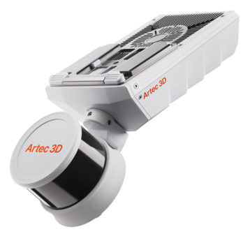
Why Artec 3D?: Mounting the ultra-versatile Artec Jet to a backpack allows you to capture wider environments as fast as you can explore them. Simply walk your site, close the loop, and Artec Twins will generate a virtual replica for visualization and analysis. You can also deploy Artec Ray II inside scenes and combine datasets for higher accuracy where you need it.

Since opening in 2006, Fluor Field has played host to Greenville Drive, a South Atlantic League affiliate for the Boston Red Sox. Built to replicate the dimensions of Fenway Park, home of the Red Sox, the ground even features its own version of the iconic “Green Monster” field wall.
Maintaining the South Carolina stadium is no mean feat. New seating, lighting, and concourse amenities are constantly being rolled out to improve the fan experience. Ground staff need to contend with a busy schedule, as well as tight construction timelines. Renovation can also be complicated by a lack of as-built data – existing designs may not reflect reality after 20 years.

Fluor Field baseball stadium. Image courtesy of Digitize Designs
To showcase Artec 3D scanning’s potential in this area, our team of experts, flanked by Artec Ambassador Digitize Designs, headed out to capture Fluor Field with Artec Jet SLAM-based LiDAR mapping – and as you can see from the results, it knocked the ball out of the park.
Digitizing a stadium in just 30 minutes
Sometimes you arrive on-site, and things don’t go to plan. In this case, Artec’s support team were told the stadium would be empty – removing potentially troublesome moving objects from the scene. However, it simply wasn’t the case when they arrived. Fluor Field remains a hive of activity between games, as staff, mowers, and sprinklers continue working around the clock.
Fortunately, Artec Jet is equipped for such a scenario. The device is incredibly flexible; it can be deployed by hand, backpack, pole, cage, vehicle, robot, or even a drone. Walking through the ground with Jet attached to a backpack proved to be the most straightforward option here.

Artec Jet mapping the facility while attached to a backpack. Image courtesy of Digitize Designs
Artec 3D scanning expert Nolan Doktor started at the exterior, then proceeded inside to capture the seating, boxes, balconies, and the labyrinth of rooms in Fluor Field’s interior. Jet’s 300-meter range and equipped GoPro enabled him to scan a whole scoreboard on the “Green Monster” wall from ground level in full color, as well as background advertising and other buildings.
To minimize exposure to the stadium’s sprinklers, Doktor then hopped onto a Gator vehicle that was mowing the pitch, allowing for a quick loop around the perimeter and full area capture.
“When I was capturing the baseball field, they were doing work,” explained Doktor. “There were groundspeople, sprinklers going off in the middle. Artec Jet is IP65-rated, so it can withstand harsh conditions like rain. But there’s no need for unnecessary exposure. So, I jumped on this little off-road vehicle – it’s really cool the speed of capture that’s possible with Jet. And for it to still keep tracking is very impressive!”
Visualizing field data in Artec Twins
Designed specifically for handling large datasets, Artec Twins not only processes Jet scans, it comes with the tools needed for dynamic visualization and analysis. The software renders huge environments at high speed, allowing users to instantly review data, traverse captured point clouds, and toggle between height, color, trajectory, capture time, and orientation overlays.

A digital twin of Fluor Field baseball stadium.
Interestingly, using the platform’s elevation filters, Doktor says it’s possible to identify individual rooms and capture complete as-built floorplans for use cases like interior design, renovation, or safety planning. Artec Jet also works with RTKs and ground control points (GCPs), which act like targets in handheld 3D scanning – these would allow Jet to “focus in” on certain floors.
Adding Artec Ray II, a 1.9mm accuracy tripod-mountable LiDAR scanner to the scene would allow for finer detail to be picked up in critical areas like doors, windows, and intersections. But in this case, Jet was more than up to the job. Panoramic 360o color capture ensured areas ranging from entry gates to a gift shop and a child’s play area were digitized with incredible fidelity.
For Digitize Designs, who coordinated the scan as part of a wider showcase, the project was an absolute hit. “We had visitors working everywhere from automotive to surveying – and they loved it!” said Bo Helmrich, the company’s director of customer success. “It was challenging to capture the entire stadium, inside and out, in no time at all. It’s fair to say that Jet crushed it.”
Artec Jet: As-built data at your fingertips
With Fluor Field actually renovated ahead of the current season, it’s clear that Artec Jet has an important role to play in future infrastructure projects. It’s often the case that historic buildings have no floor plans, so capturing as-built surfaces is vital to maintenance and renovation.
“Our event was hosted just beside Fluor Field, so it seemed like an impressive thing to scan. But I can absolutely see Artec Jet scans being used in practical upfitting and referencing applications,” added Helmrich. “This would reduce the need for manual measurements if they were adding to the facility, and minimize the potential for human error.”

Fluor Field baseball stadium in Artec Twins with the elevation mapping overlay.
If they were tasked with expanding Fluor Field’s capacity, for example, architects could overlay proposed section layouts onto Jet point clouds and verify sightlines or structural clearances without a single return visit. The same applies to door widths and ceiling heights with concourse renovations. Even a scoreboard or lighting retrofit becomes simpler when engineers can confirm mounting points and cable runs against existing infrastructure in Artec Twins.
Crucially, Artec Jet’s 30-minute capture window means that data can be gathered between games. With Artec Twins’ Gaussian Splatting functionality generating lifelike visuals from the same dataset, applications extend into heritage preservation and virtual fan experiences too. For those managing aging venues on tight schedules, Artec Jet could be a real game-changer.
This project was carried out alongside US Artec Ambassador and Artec Jet reseller Digitize Designs. Reach out directly to discover more about long-range, SLAM-based LiDAR mapping.
Scanners behind the story
Try out the world's leading handheld 3D scanners.
More cases